Cinemascapes
From screen to street. A mobile experience that turns the films you love into places you can explore.
- My focus
- Experience design, maps + visual system
- Format
- Mobile web app, React + Mapbox
- Project stage
- Product concept
The opportunity
The inspiration is cinematic. The planning rarely is.
A film gives a place meaning before we ever arrive. But getting there can mean piecing together a moodboard, a location list and a map. The opportunity is in the spaces between the landmarks: carrying a scene’s context, colour and atmosphere through the journey itself.
The evidence
People want this. The drop happens when the trip becomes work.
One Expedia statistic is a claim, so I checked it against independent surveys, search behaviour, destination economics and what visitors say once they arrive. Inspiration sits between 60 and 80 percent. Conversion into a booked trip sits near 20. The distance between those two numbers is where a planning product lives.
Plan holidays around places seen on screenGen Z and Millennial travellers
Inspired to visit by a show, news story or filmUS travellers
Booked a trip after seeing it in a show or filmTravellers worldwide, 1 in 5
“Set-jetting” is the industry’s name for the behaviour and barely registers as a search. People type the film’s title and the words filming locations, which is a planning query, not a dreaming one.
What exists
Everyone sells the destination. No one designs the trail.
The database layer exists. The booking layer exists. The guided-coach layer exists. The leading app’s reviewers ask for a place to keep the spots they starred so they can follow them on the trip. The most requested feature is the product.
Route analysis
A film is not one kind of trail.
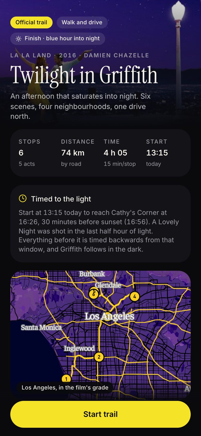
Every guide publishes a list of addresses in plot order, which is a route for neither of these films. Across every documented location, La La Land is a day of driving across a county and Amélie is mostly a walk, so I order stops by the street, not the script.
La La LandLos Angeles
3 of 12 legs walkable
Warner Bros. Studios to The Smoke House220 m, walkable
146 km by road
AmélieParis
10 of 11 legs walkable
Lamarck–Caulaincourt to Rue Saint-Vincent460 m, walkable
12 km by road
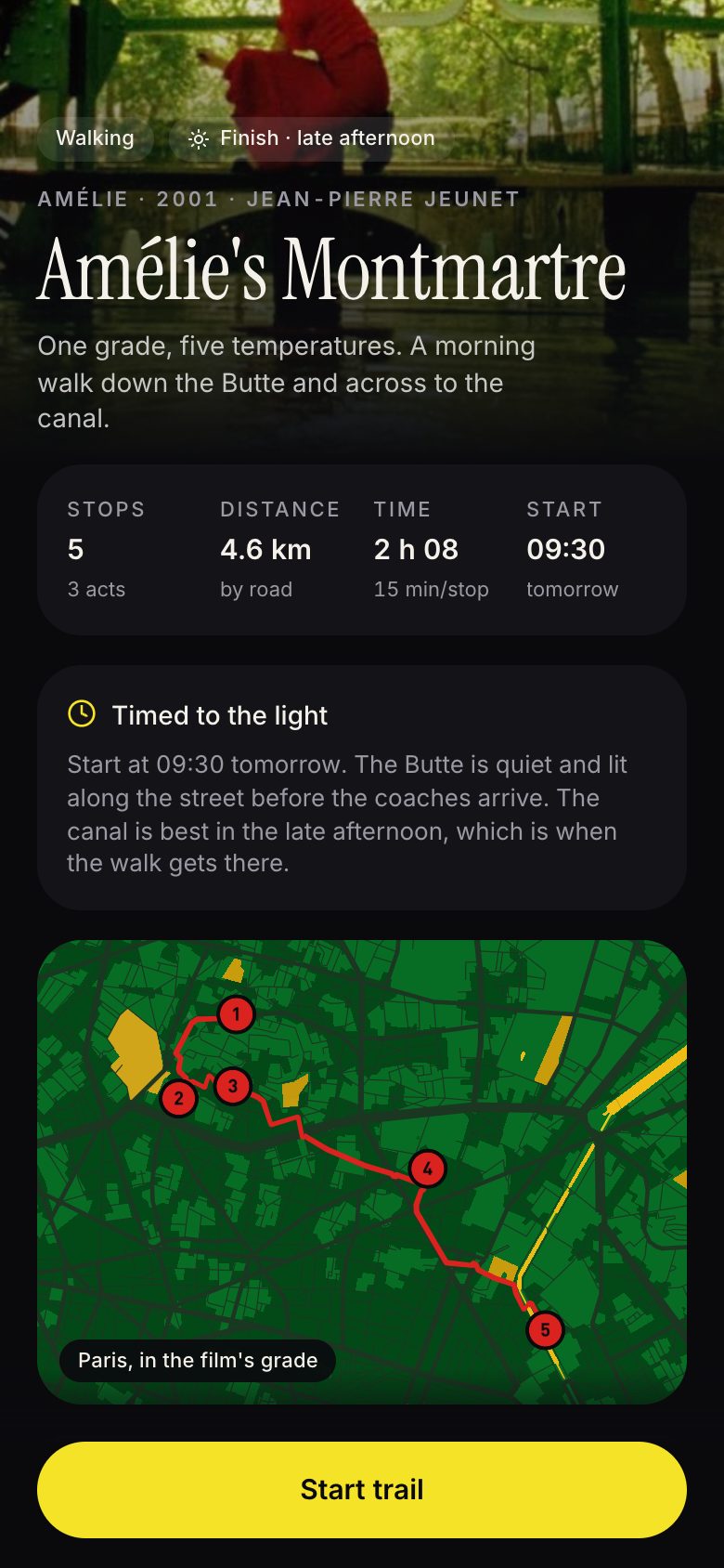
The trails in the app take a cut of each: six stops and 74 km by road in Los Angeles, five stops and 4.6 km in Paris. The plan shows the commitment before you start, and it times the whole day backwards from the light the key scene needs.
Theory of the trail
A director puts a feeling on film. The trail puts it back on the street.
Set-jetting is usually treated as finding an address. The feeling people travel for was manufactured by specific decisions about colour, light, frame, movement, dressing and sound. Most can be recovered in the real place, but only if the trail knows which ones they were.
Palette and grade
The violet sky is a colour grade, not the weather.
The city is re-scored in the film’s palette so the grade travels with you.
Light and hour
Magic hour. At noon the same view is haze.
Each stop carries a best hour, and the plan times the day backwards from the key scene’s light.
Frame and vantage
Camera height, lens and standing point decide the picture.
The viewfinder aligns the frame and gives an approximate heading.
Movement
The dance travels along the road. Scenes have a direction.
Where it is possible, legs follow the characters’ direction of travel, and the stop says so.
Production design
The bench and the lamp were set dressing. There is no bench.
A reality check on each stop flags what was set dressing.
Score
A song owns the scene and tells you how to feel in it.
A compact soundtrack control plays a preview of the score on the approach.
The closer model is a theme park, not a map app. A ride is a sequence of scenes with the transitions designed as carefully as the scenes. A trail through a real city needs the same seven beats, with the city standing in for the set.
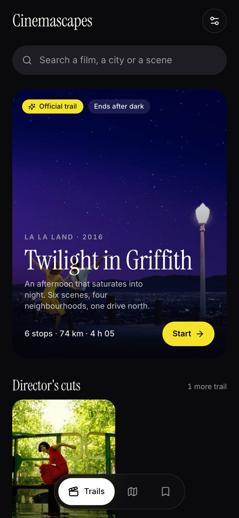 MarqueeThe poster at the gate sells the world.Discovery opens on a scene.
- QueueThe wait tells you how long it is.The overview sets time, distance and tone.
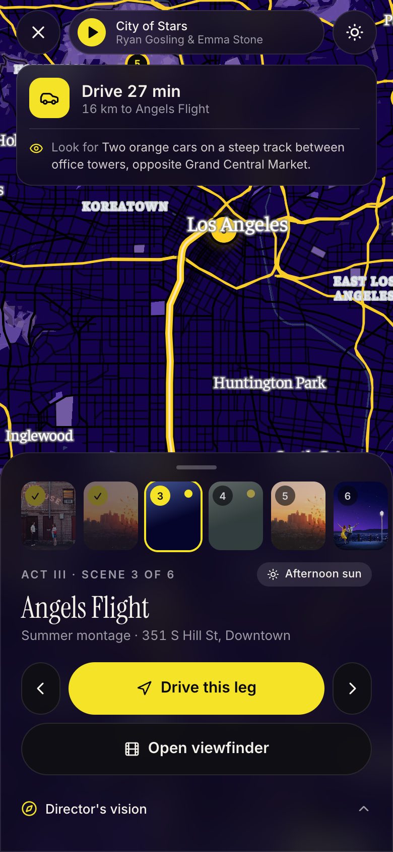 WeenieA landmark pulls you forward without a sign.Each leg points at the next stop.
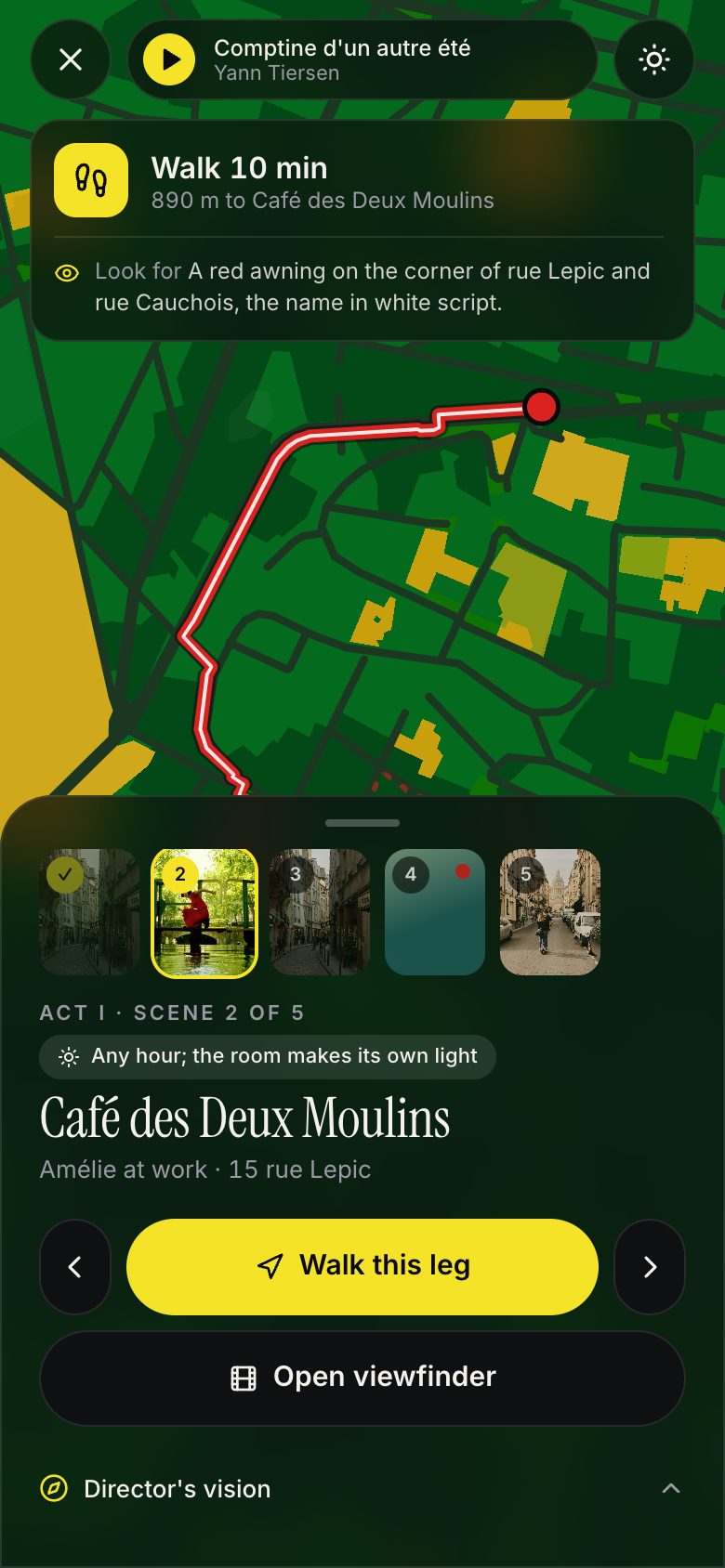 BermA mound hides the car park.Palette and score stay on between stops.
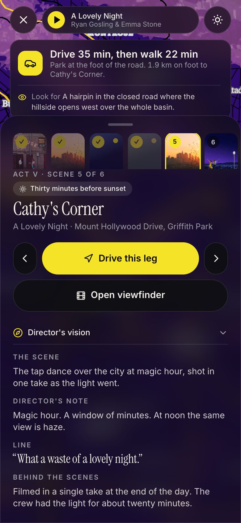 SceneEach room has one job.Context expands when you want it, then folds away.
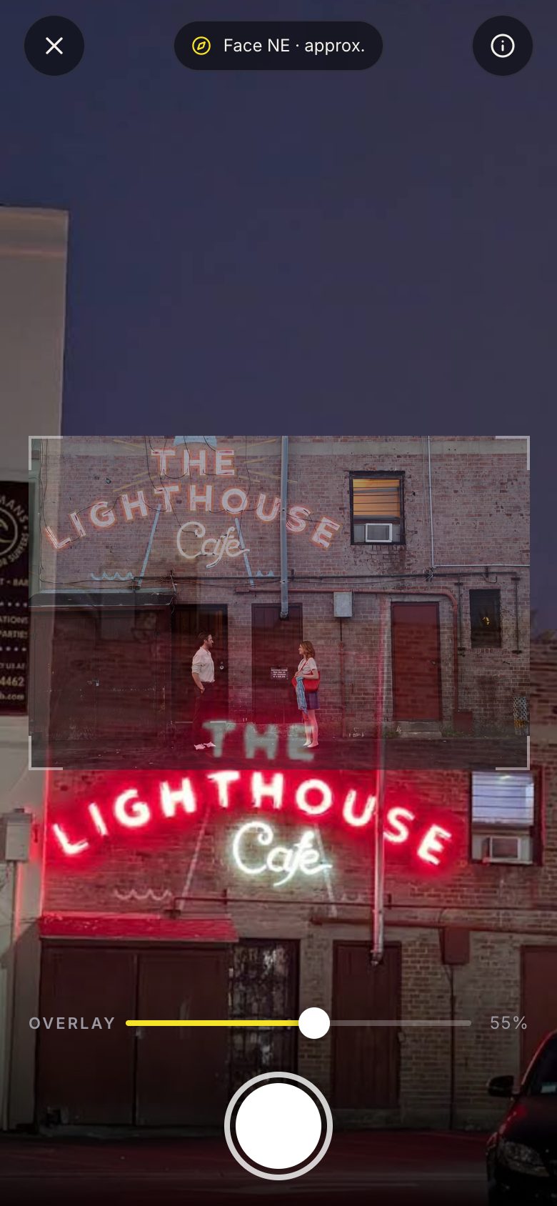 FinaleThe last room is the one you came for.The viewfinder lines the film up with the place.
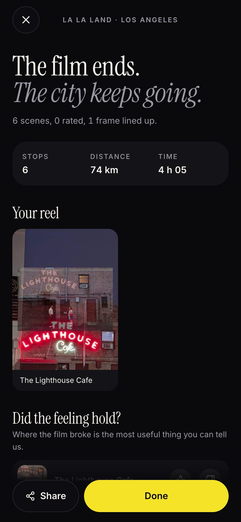 Gift shopYou leave with something to keep.Your reel of lined-up frames is the proof you take home.
Finding a way in
Enter through the film, land in the city.
People search a film’s title, so the film is the door. A map of pins by city is how every database already fails. Discovery leads with a recognisable scene, the map is the second door, and saved trails give a passing interest somewhere to live until the visitor is ready.
Cinematic cartography
What if the map felt like the film?
The city provides the structure; the film provides the emotional register. I grade by role, not resemblance: the film’s dominant colour goes to the map’s largest surface, its light source to water and parks, and its protagonist’s colour to the route and the one action.
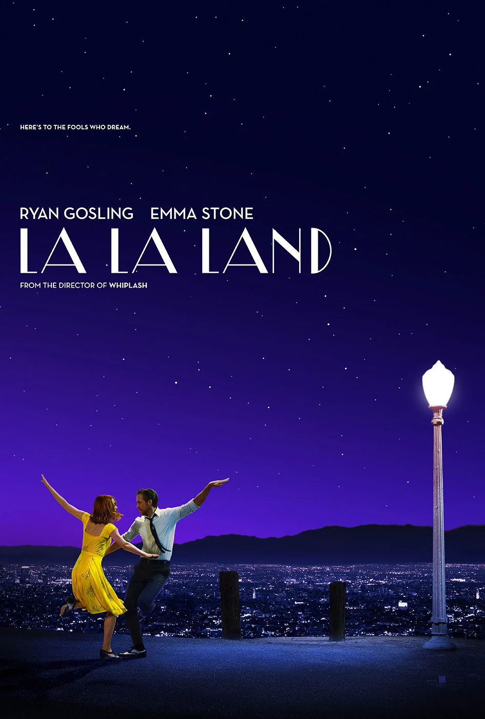
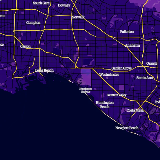
La La LandLos Angeles
- Midnight
- Twilight
- Spotlight
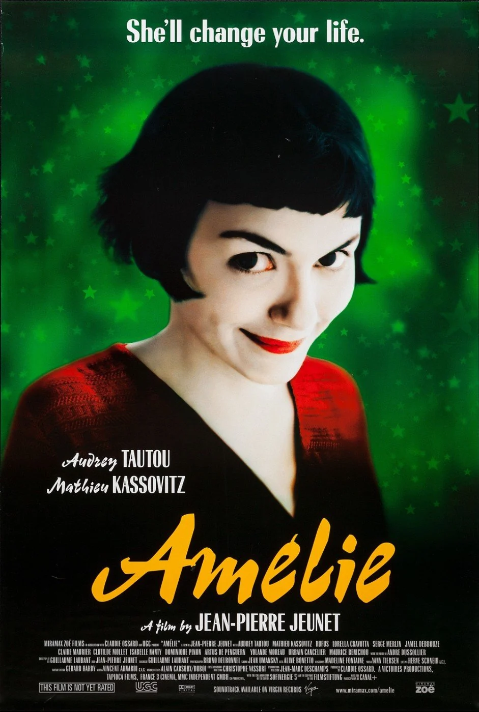
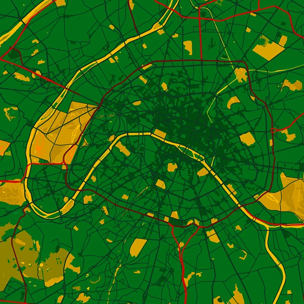
AmélieParis
- Green
- Gold
- Red
The colour script
A film is not one palette. Neither should the trail be.
Three colours is the right first move and the wrong last one. Films are planned colour by scene, as in Pixar’s colour scripts, and La La Land let its costumes desaturate as the couple matured. So each stop inherits its scene’s grade, and the map dissolves to it as the trail moves on. Only the ground and the light move; the route’s accent holds, because atmosphere moves and wayfinding doesn’t.
The palette can carry emotion, but directions still need to be unmistakable. A daylight guard keeps the hue and lifts the roads.
Scene palettes are read from stills by eye and blended into each film’s base map.
The connected experience
Different worlds. A familiar way through.
The app connects discovery, planning, navigation and scene context. I kept the map in the film’s palette instead of handing off to Google Maps between stops, which would be cheaper and break the spell. Soundtrack, prompt and stop card hold their positions, so the world changes inside a fixed frame. Each leg has its own travel mode, and context expands when you want it, including what was dressed or isn’t there at all.
The moment of arrival
You found the place. Now find the frame.
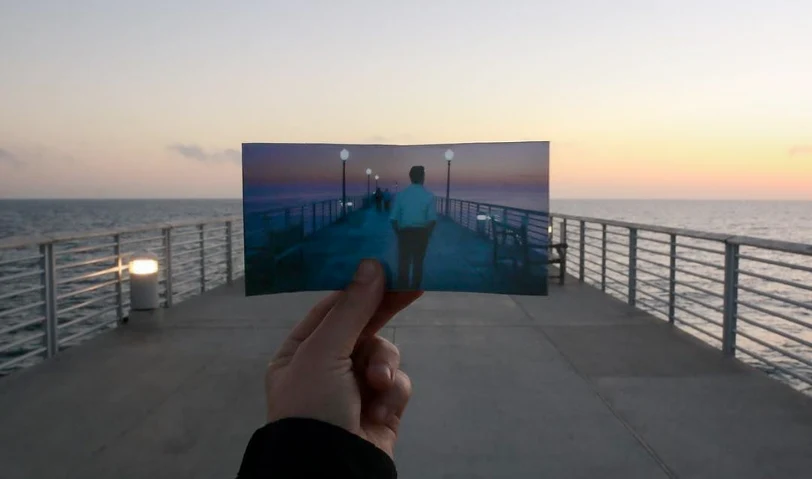
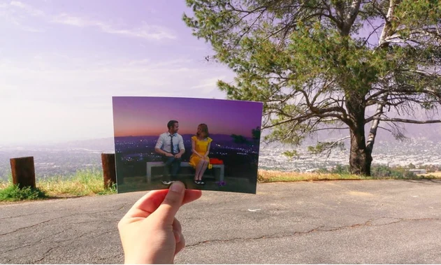
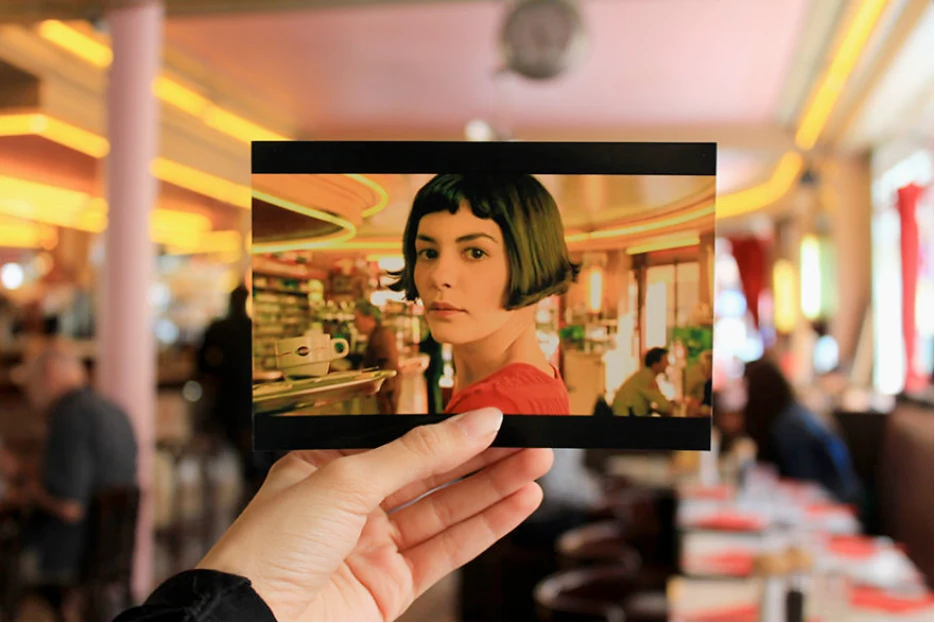
Expectation is set on screen, and disappointment happens on the pavement. A photo gallery would show the scene but not where to stand, so an adjustable overlay invites the visitor to line up the film with the place in front of them. Take the shot and it goes in a reel, and the trail ends by asking where the feeling held and where it broke.
A reference photo stands in for the street here. Film stills are for concept use only, and “Official trail” and bookings are placeholders: no studio partnership or partner is claimed.
The service
A trail is a day out, not a map.
The screens are the visible half. A trail is a day: something happens before you leave, something on the street and something after. Most of what makes it work sits behind it: sourced stops, scouted standpoints, the right to use a still, and a city’s rules.
- Find a film, by title or on the map
- Say how you’re getting around, and whether you’ve seen the film
- Save the trail, or book a partner stop
- Stops researched, sourced and scouted for standpoints
- Routes by mode, opening hours and the light the key scene needs
- Rights to stills and tracks; partner slots
- Follow the graded map, the track playing on the approach
- Find where to stand, line up the frame, read the card
- Stop for food, then pick the trail back up
- Directions, metro changes and the daylight guard
- Each stop’s access decides what it offers
- Residents’ quiet hours and a city’s right to pause a stop
- Keep the reel of lined-up frames
- Say where the feeling held and where it broke
- Answers rewrite stops that break
- Footfall reported to partners
Before the plan, the trail asks three things it can’t guess. How you’re getting around. Whether you’ve seen the film, so the last act holds its scenes back. And whether you have headphones, because a soundtrack on a phone speaker is noise on someone else’s street. The first answer changes the whole day.
Walk and metro1 h 52 of it on foot, 8.9 km
Bike or scooter33 km of Delhi roads
Car or cabbefore traffic
On foot29 km, a day of walking
By metro, more than half the travel time is walking, most of it between the station and the stop. By car the day looks shortest and gives some of it back to Delhi’s traffic. So the mode is the visitor’s choice, not the trail’s. Each answer reroutes every leg, and the start moves so the day still reaches the dargah before sunset, when the qawwali begins.
Access and residents
Some stops you can’t enter. Some you shouldn’t.
Every trail has stops that are closed, timed, governed by rules or not there at all. So access decides what a stop becomes, not only whether it’s shown. Five rungs cover every stop on the three trails.
- Any time
Stand where the camera stood.
Central Park in Connaught Place, Canal Saint-Martin, Cathy’s Corner - At set hours
The plan times the day around the hours, and says what to buy.
The Lighthouse Cafe, Café des Deux Moulins, Griffith Observatory - With rules
Rules on dress and photography arrive before you do. The track is cued at the gate, never inside.
Nizamuddin Dargah - From outside
The gate is the standpoint. The track plays and a card tells you what happened behind the wall.
Hindu College, St. Stephen’s, Rialto Theatre - Not there
A set, a private interior or a home. It stays a card, never a pin.
In the Mood for Love’s sets, Lost in Translation’s hotel
The other limit is the people who live there. Screen tourism has a record of turning streets into sets, and places push back.
On the Amélie trail. Residents say tour groups block their front doors; a deputy mayor calls it the Instagram effect.
Standpoints on public ground, and quiet hours on residential streets.
Fans of Slam Dunk stand in traffic at a level crossing. The city set up a photo spot in a nearby park, and crowds drift back when staff leave.
A safer standpoint only works if the frame from it is as good.
A town put up a 20-metre screen to block a viral view of Mount Fuji after visitors kept running into the road.
A place can withdraw. The trail has to be able to drop a stop.
The owners of the Breaking Bad house built a fence after fans kept throwing pizzas on the roof.
A private home is never a stop.
So the trail keeps rules of its own. Standpoints stand on public ground, and a private home is never a stop. Residential streets get quiet hours, the track plays through headphones, and start times are staggered when many people plan the same trail for the same day. A city or a site can pause a stop, and the trail reroutes around it.
The business case
Film tourism already has the money.
Cinemascapes is a product concept, and the financial case is straightforward. Inbound visitors spent £892.6m on film-related screen tourism in the UK in 2019, and travel platforms sell where to stay but not what you do once you’re there.
None of what a trail needs belongs to it. Each party gives something and expects something back, and residents are the one party with nothing to gain unless the trail spends locally. That’s why access and quiet hours live in the product, not on a policy page.
The trailMakes the route, the grade and the cards. Owns none of the above.
- Gives
- Stills, clips and the right to use them
- Gets
- A catalogue that earns between releases
- Risks
- Control over how the film appears on the street
- Gives
- Soundtrack previews
- Gets
- Plays, at the place the song belongs to
- Risks
- Little
- Gives
- Where scenes were shot, and permits
- Gets
- Proof that filming brings visitors
- Risks
- Crowds at locations they vouched for
- Gives
- Promotion, local data
- Gets
- Visitors beyond the famous spots
- Risks
- A trail that piles them onto one
- Gives
- Access, hours and rules
- Gets
- Customers, where they’re open
- Risks
- A crowd at a gate that earns nothing
- Gives
- Nothing, by choice
- Gets
- Nothing, unless the trail spends locally
- Risks
- Noise, blocked doors, their street as a set
Each measure has a definition, the unit it’s read at, and the decision it feeds. The test rounds read the first five by hand; partner footfall waits for partners.
CompletionPer trail
Share of trails started that reach the last stop the same day.
Where most people drop out, that leg is shortened or the trail splits in two.
Finding the framePer stop
Median minutes from arriving at a stop to lining up the frame.
Slow stops get a clearer standpoint, or the standpoint moves.
PacePer stop
Median minutes spent at each stop against the minutes planned.
The plan’s timings are rewritten; stops nobody lingers at are cut.
Feeling heldPer stop
Share of thumbs up for each stop on the finish screen.
Stops that keep breaking get an honest reality check, or go.
Leaving the appPer leg
Share of legs where the visitor switches to another map.
Legs people leave on get better directions before anything else.
Partner footfallOnce partners exist
Visits to a partner stop from the trail, against a normal week.
Whether atmosphere is worth paying for.
Past two trails
Trail fifty is made by people who live there.
Two trails were made by hand, and so was the third. Laid out step by step, the split is clear: the app can already route and time a trail, and could suggest a palette. Sourcing scenes, checking access and finding standpoints take a person, on foot, in that city.
Pick the filmSearch demand, and whether its locations are documented at all.
Source the locationsEvery stop tied to its scene, and how many sources agree. For Delhi this was most of the work.
Check access and residentsIts rung on the ladder, its hours, and whether people live there.
Find the standpointsOn foot, frame in hand.
Read the colour scriptA palette per scene from the stills. Read by eye today; extraction could suggest and a person picks.
Route and time itLegs by mode, metro changes, the day timed back from the key scene’s light. Built.
Walk it and correctThe test rounds.
So trail fifty won’t come from a better algorithm. It would come from people in each city working to one method: film students, location scouts and the film offices that already keep the lists, with every stop marked by how many sources agree, and the first walk counted as the last step.
The test trail
A trail I can walk changes what the trail has to know.
Los Angeles and Paris came with fan-made maps. A test needs a trail I can walk again and again, so I built a third in Delhi, where I live: Imtiaz Ali’s Rockstar, from the two colleges on Sudhir Bose Marg to Nizamuddin Dargah, five stops in a day by metro. Preparing it surfaced what the first two had hidden.
Hindi films have no fan trails, so the research becomes part of the product: three of the five stops are tied to their scenes by more than one source, and the app says so when a stop isn’t verified. Both colleges turn strangers away, so they became stops you take from the gate: the track plays and a card tells you what happens behind the wall.
The testing is slow by nature and runs in rounds. First I walk it alone, more than once, on Thursdays so the day ends at the evening qawwali. Later rounds bring five to ten people who know the film, with me walking behind them and not helping. Each round feeds changes back into the app before the next one. What’s fixed now is what each round records: at each stop, the minutes from arriving to finding where to stand, whether the gate stops still carry the scene, whether the feeling held, and anywhere someone switched to Google Maps.
Where it fell short
The Delhi trail exposed what the first two hid.
Building a trail I can walk turned up problems two trails abroad never could. Some are fixed. The rest wait for the street.
Delhi’s metro legs were routed as car journeys. Now a leg walks to the station, rides and walks on. Fixed.
Hindu College and St. Stephen’s face each other across one road. The router sends you 930 metres round. Open.
The trail starts at stop one, so arrival never fires there, and its track never cues. Open.
Scene palettes are read from stills by eye, and Delhi’s map colours are still a draft. Open.
Where it stands
The feeling is there. The journey needs to earn it.
None of this has been tried on a real street yet. The clearest lesson is that atmosphere and utility have to develop together: a beautiful line between two places is only the beginning of a usable trail.
Everything here now waits on the walk: the measures, the standpoints, the gate stops, the stretch from the station and the questions before the plan. The Delhi trail will be walked in rounds, and this page will change with each one. The film ends. The city keeps going.